Elements of a map
Helps for the understanding and reading of a map
Scale: Explains the relationship between the data frame and the real world. Shows the places´sizes.
Projection: Representation of the Earth´s surface
- Cylindric
- Pseudocylindric
- Conic
- Planar
Symbols: Symbols allow us for ease our understandig of how to arrive somewhere
Types of Maps
General reference: These are simple maps showing important physical feautures in an area
- Transit map
- Topographic map
- Political map
Thematic: Shows the spatial distribution of identifiable earth surface features.
- Physical map
- Climate map
- Land use map
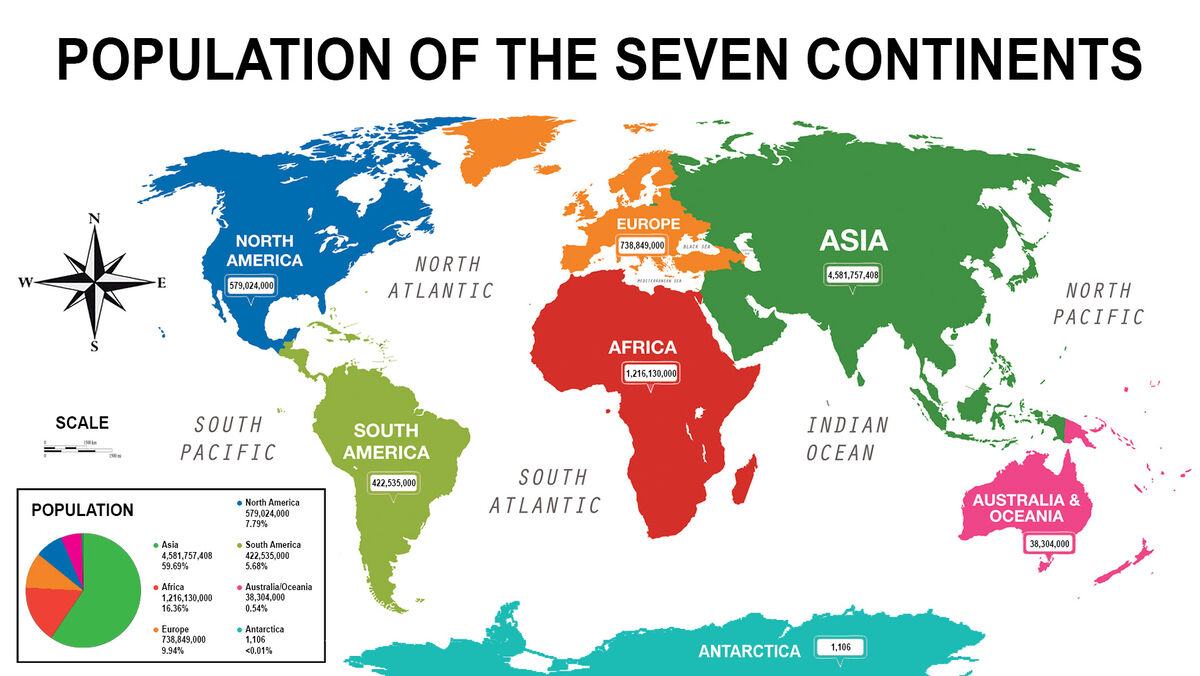
- Population map
Compass Rose
Earth has a magnetic field that surrounds it. The compass uses motion-sensitive needles. Thanks to the magnetization of the needle, one end of it always points to the North, in this way we can know what the other cardinal points are. The compass is a tool that had helped sailor across the ocean. Nowadays this had been an incredible implement for localization.
You can make your own compass with a needle, a magnet, a cork, a little bowl and water.
First you have to magnetize the needle with the magnet, after that insert them in the middle of the cork, and finally put in on the bowl with water and look how it moves.

Carvajal, G. (2023, January 17). The compass: what it is and how it works. The Green Compass. https://www.labrujulaverde.com/2005/05/la-brujula-que-es-y-como-funciona


No hay comentarios.:
Publicar un comentario